

Walking in Madrid’s Sierra de Guadarrama
by Ben Curtis
This article on walking in the Sierra de Guadarrama (with a treat for Google Earth users at the end!) comes from Graeme at South of Watford. Graeme has lived and worked in Madrid for almost 10 years and writes regularly in his blog about current events in the city and Spain, together with occasional articles on different aspects of Spanish culture.
“For much of my adult life I hated the idea of walking in the mountains. I had some unhappy childhood memories of stumbling around behind my father, lost on foggy, boggy hillsides in the north of England. Soaked to the skin and frozen, we would finally get off the hills only to end up in a cold, gloomy youth hostel; it put me off the idea for years. I think I began to change my mind the first time I came to Spain; as I travelled along the coast of Cantabria and Asturias looking at the sunlit foothills of the Picos de Europa. It was that missing element in Britain that did it - sunshine. However I didn’t really change my opinion until I came to live in Madrid several years later, the mountains of the Sierra de Guadarrama are so accessible from the city that it was almost inevitable that I would eventually get there.
At first my partner and I went walking with organised groups, and we still do occasionally - although now we are just as likely to go off on our own or with friends. Two of the companies we have used often for day walks or even longer trips are Tierra de Fuego and Geographica; although there are others that operate in Madrid. The advantage of going with these companies is that they have experienced guides and they take you there and back, it’s a great way to discover routes that you might never find out about otherwise. The main disadvantage can be that walking across a mountain in the company of 40 other people is not always a very peaceful experience.
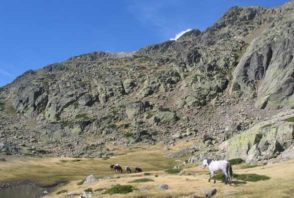
The accessibility of the mountains from Madrid means that it’s not very difficult to do something on your own initiative, even without a car. The simplest way I know to get into the heart of the sierra is to get on a Cercanias train from Madrid (Atocha or Chamartin) to the village of Cercedilla. From Cercedilla there are two main options.
The first option is to take another train from Cercedilla station, el Tren de la Naturaleza, which winds its way around a beautiful mountain route via the Puerto de Navacerrada and finishes at the Puerto de Cotos. At Cotos you are already at a height of over 1800 metres. For the more determined walker the logical route to take from here is that which takes you to the top of the highest peak in the Sierra de Guadarrama at over 2400 metres, Peñalara. Personally, I would not do this route in winter; every year there are accidents as the ill-prepared and even the more experienced walkers get into trouble on the ice covered rocks on the far side of the peak. When there is no ice it is perfectly accessible. For those who want an easy walk around Cotos the best option is to head along the well marked path to the glacial Laguna Grande de Peñalara, only 45-60 minutes from the railway station at Cotos and with fantastic views. For a route that is longer but not over strenuous, you could continue further to the Laguna de los Pajaros. The trains to Cotos usually coincide with arrivals from Madrid, but check the timetable in advance as there is not always a Cotos train coinciding with the Madrid arrival.
The second option from Cercedilla is to walk directly up the valley of Fuenfria. Walking to the end of the main platform towards the tunnel, you take a right turn onto a path marked with painted blue circles. After a short climb up from the railway line you get onto a broader path and continue to follow this for the next 3-4 kilometres until you reach the hospital. Turning right here, and still following the painted circles marked on the trees, you get to an information office where you can get a rough plan of all the marked routes in the area.
From this point you can either opt for a route that takes you high up to somewhere like Siete Picos or Monton de Trigo, or you can just go for a shorter walk in the beautiful pine woods around the valley. A direct medium length route along the old Roman road, the Calzada Romana, takes you up to the Puerto de Fuenfria from where you can look down onto the Segovian side of the Sierra. In this area there are plenty of options for both long and short walking routes.
It’s important to go well prepared, especially if you are aiming for the higher ground above 1500 metres. The weather can change very abruptly and at 2000 metres temperatures can drop sharply. I remember eating my lunch in the sunshine on Siete Picos one day last winter; only to be stumbling around in freezing fog 20 minutes later as the clouds moved in and the wind made it extremely cold. Any time outside of the summer months it is vital to have good quality warm and waterproof clothing. Good boots are needed too, the higher areas can be very rocky. In addition a reasonable map and a compass are always important things to have. Despite the note of caution about weather conditions, winter or early spring can be a fantastic time to go; a crisp clear sunny day with a bit of snow still on the ground and you don’t even need to think about those windy, wet British hillsides.”
Google Earth users: Graeme has prepared a .kmz file showing all the main areas mentioned in the article. Download the file using this link: Guadarrama_pts.kmz and double click it to launch Google Earth. Don’t have google earth? Get it here, it’s pretty amazing!


Comment from Marina
Date: February 20, 2007, 10:51 am
I use to walk to the Laguna de Peñalara every summer with my family when I was a kid… the good thing then was that one could swim in the Laguna after the walk in the sun, which was an amazing experience as the water was always as cold as ice even in the most hot summer. These days it is forbidden.